Dieses Lehrbuch vermittelt Ihnen Einblicke, wie Gletscher, Bergstürze, Flüsse oder Vulkanausbrüche die Reliefformen unserer Erde erschaffen, verändern und zerstören.
In this new volume in the World Soil series, the various types of Icelandic soils, their different characteristics, their formation, degradation and erosion are reviewed.
This book offers a comprehensive overview of the alluvial fan phenomena, including all terminology, morphology, sedimentology, controlling factors, processes and the human impact.
This book presents the natural, environmental and scenic richness of the world's coastal and marine areas classified by UNESCO as "e;Natural World Heritage Sites"e;.
This book highlights major problems in the statistical analysis of compositions that have been known for over a century, as well as the corresponding solutions that have been put forward by specialists over the past 30 years.
After providing a historical overview, this book highlights the current state of knowledge, gaps in our knowledge, recent findings and future prospects with regard to the biological, chemical, geological, and geographical specificities of the Plitvice lakes in Croatia.
This book is the result of comprehensive research work on the various aspects of the West Bengal coast including the world's largest riverine delta system, the Ganga-Brahmaputra Delta.
This volume covers the floods of the major rivers of the Ganga-Brahmaputra-Meghna (GBM) Delta, and storm surge related coastal floods in these regions.
The updated textbook is intended to serve as an advanced and detailed treatment of the evolution of the subject of stratigraphy from its disparate beginnings as separate studies of sedimentology, lithostratigraphy, chronostratigraphy, etc.
This book investigates the historical evolution, regional differences, and quantitative measurement on street interface, which forms the street space and plays a very important role in urban form.
Students taking undergraduate degrees in geography, ecology, earth science, and environmental science frequently take an introductory unit in Physical Geography.
The past half century has seen an evolution in thinking from 'flood control' to 'flood risk management', recognizing that risk results from both hazard and vulnerability.
This book documents and describes 32 natural caves from France and around the globe that have a width larger than 50 m, including data on the largest underground chamber in the world: Sarawak Chamber.
This edited volume brings together a collection of works that comprehensively address both the myriad geomorphological landscapes of the Maltese Islands and how their evolution has been shaped over various time-scales by different sets of processes.
This book provides insights on new geological, tectonic, and climatic developments in India through a time progression from the Archean to the Anthropocene that are captured via authoritative entries from experts in earth sciences.
This book presents varied geomorphological topics and planetary studies from different geomorphological regions analysed by young researchers from Latin America, from Costa Rica to southern Argentina, from the mountains to the oceans, and from the Caribbean to the Scotia tectonic plates.
This book presents varied geomorphological topics and planetary studies from different geomorphological regions analysed by young researchers from Latin America, from Costa Rica to southern Argentina, from the mountains to the oceans, and from the Caribbean to the Scotia tectonic plates.
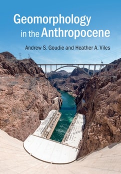
This book provides a comprehensive and systematic analysis of the morphodynamic process of the Changjiang River from upstream to estuary in the Anthropocene.
A lo largo de la historia de la humanidad, los meteoritos siempre irrumpieron desplegando el asombro, la sorpresa ante lo que no encuadra en los compartimentos de los conocimientos previos, la incomodidad ante lo que no encuentra su lugar en un edificio teórico largamente consolidado.
These proceedings contain papers by some of the world's leading experts in the analytical and numerical modelling of sediment transport, its measurement on site and in the laboratory, river and coastal morphology, and similar issues.
This book is unique in its ambitious and comprehensive coverage of earth system land surface characterization, from observation and modeling to data assimilation, including recent developments in theory and techniques, and novel application cases.
This book tells you where beach sand comes from, how waves are formed and how they break and move sand down the coast, how "e;works of man"e; have blocked this movement and caused beach erosion, and what can be done to save the beaches for future generations of Americans.
This book investigates the historical evolution, regional differences, and quantitative measurement on street interface, which forms the street space and plays a very important role in urban form.
This book provides a comprehensive and systematic analysis of the morphodynamic process of the Changjiang River from upstream to estuary in the Anthropocene.
This book focuses on the survey technology, post-processing technology, mapping technology and scientific application of the submarine topography and geomorphology in detail.
This book highlights major problems in the statistical analysis of compositions that have been known for over a century, as well as the corresponding solutions that have been put forward by specialists over the past 30 years.
Mars has been extensively photographed by cameras and compositionally detected by spectrometers onboard orbiters on a global scale, and explored in-situ by landers and rovers at both local and outcrop scales in different locations.
This book presents the natural, environmental and scenic richness of the world's coastal and marine areas classified by UNESCO as "e;Natural World Heritage Sites"e;.
This book offers a comprehensive overview of the alluvial fan phenomena, including all terminology, morphology, sedimentology, controlling factors, processes and the human impact.