This book provides a cross-disciplinary perspective on the degradation and deterioration of the cultural record encompassed by urban headstones located in parish churchyards.
This book describes the interrelationship between the spectacular geology of an area of East Africa that includes a branch of the rift valley, as well as giant freestanding ice-capped mountains and extraordinarily toxic, alkaline lakes, and some of the greatest concentrations of wildlife on Earth.
This book presents the most relevant basaltic plateau exposures in the provinces of Neuquen (northern Patagonia) and Santa Cruz (southern Patagonia), and analyzes their geomorphological and morphometric characteristics.
The past half century has seen an evolution in thinking from 'flood control' to 'flood risk management', recognizing that risk results from both hazard and vulnerability.
This book discusses the geology, hydrogeology, and water quality/geochemistry of karst systems in geologically young terrain, using the state of Florida as an example.
This unique book addresses Iran's extremely rich soil diversity and resources, which have developed under various climatic conditions ranging from dry to humid conditions.
This book presents chapters, written by leading coastal scientists, which collectively depict the current understanding of the processes that shape barrier islands and barrier spits, with an emphasis on the response of these landforms to changing conditions.
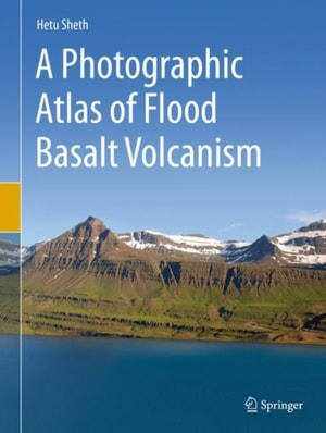
This unique book presents hundreds of spectacular photographs of large-scale to small-scale field geological features of flood basalt volcanism from around the world.
This book gathers older and current knowledge of the evolution and functioning of cuesta landscapes to provide a better understanding of the Luxembourgian landscape.
This volume brings together the geological, geomorphological and ecological aspects of Japan's natural heritage, arguing for dynamic conservation of such heritage and explaining their key characteristics in an accessible format for general readers.
This book focuses on the vegetation history of the cultural landscape in southwestern Slovakia, which was established and adopted by mankind and has since constantly evolved in response to ongoing changes (in environmental conditions, biodiversity, land use, etc.
Allow yourself to be taken back into deep geologic time when strange creatures roamed the Earth and Western North America looked completely unlike the modern landscape.
This book on the current state of knowledge of submarine geomorphology aims to achieve the goals of the Submarine Geomorphology working group, set up in 2013, by establishing submarine geomorphology as a field of research, disseminating its concepts and techniques among earth scientists and professionals, and encouraging students to develop their skills and knowledge in this field.
This interactive book presents comprehensive information on the fundamentals of landslide types and dynamics, while also providing a set of PPT, PDF, and text tools for education and capacity development.
This interactive book presents comprehensive information on the fundamentals of landslide types and dynamics, while also providing a set of PPT, PDF, and text tools for education and capacity development.
This proceedings volume presents selected research highlights from the Sixth Argentine Geomorphology and Quaternary Studies Congress, hosted at CADIC, Ushuaia, on April 8-12, 2015 by the Argentine Association of Geomorphology and Quaternary Studies (AACYG).
This book describes recent advances in the morphodynamics of mixed sand and gravel Mediterranean coasts, and provides updates and new methods for their study and management.
This book presents relevant and contemporary research on the remote sensing of landscapes, agriculture & forestry, geomorphology, coasts & oceans, natural hazards and wild habitats.
This book portrays the Himalayan-born River Saraswati, a legendary river that was the lifeline of a progressive and vibrant society for more than three thousand years.
These proceedings contain a selection of peer-reviewed papers presented at the International Symposium on Geodesy for Earthquake and Natural Hazards (GENAH), Matsushima, Japan, 22-26 July, 2014.
This thesis represents one of the few studies so far that systematically analyses environmental conditions within debris flow source areas to determine their relative importance for debris flow development.
This atlas illustrates the characteristics of present-day bedforms, from the shoreline to deep-sea environments, and it also includes short reviews of the main mechanisms that generate such bedforms.
This book deals with the Tsunami intrusion in the lower plain in the Tohoku region and role played by the coastal and fluvial landforms in the damages.
This richly illustrated book celebrates the diversity, importance, and intrinsic beauty of soils around the world and helps the reader to understand the ways that soils are related to the landscapes in which they form.
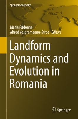
New and innovative scientific theories, discussion and explanations are presented on landform dynamics and evolution in Romania along with a comprehensive understanding of the geomorphological processes shaping the large variety of Romania's landscape.
This book combines new quantitative erosion measurement methods with a geochemical fingerprint and a model-based approach to measure erosion and sediment flux in the Wadi Al-Arab, a Mediterranean to semi-arid catchment in northwest Jordan.
This book contains a selection of peer-reviewed papers presented at the VIII Hotine-Marussi Symposium on Mathematical Geodesy in Rome, 17-21 June, 2013.
This is a highly illustrated book with each landform being described with the following structure: (1) Main characteristics, including geometric, morphometric and sedimentological features.
This book explores the latest advances in our understanding of the evolution of the Ganga-Brahmaputra delta, examining the Damodar basin, Bhagirathi-Hooghly basin and Jalangi basin from historical, quantitative and applied geomorphology perspectives.
This revised edition describes the transformation of the environment and landscape of Western Sorkapp Land based on research data collected by Jagiellonian University scientific expeditions in the period 1980-1986 and in 2008.