This book covers all aspects of inertial navigation systems (INS), including the sensor technology and the estimation of instrument errors, as well as their integration with the Global Positioning System (GPS) for geodetic applications.
The book presents and discusses a large corpus of Jewish maps of the Holy Land that were drawn by Jewish scholars from the 11th to the 20th century, and thus fills a significant lacuna both in the history of cartography and in Jewish studies.
The book presents and discusses a large corpus of Jewish maps of the Holy Land that were drawn by Jewish scholars from the 11th to the 20th century, and thus fills a significant lacuna both in the history of cartography and in Jewish studies.
Methane Emissions from Unique Wetlands in China: Case Studies, Meta Analyses and Modelling is a landmark volume in the development of studies about methane emission from wetlands.
This is the second edition of the established guide to close-range photogrammetry which uses accurate imaging techniques to analyse the three-dimensional shape of a wide range of manufactured and natural objects.
This book covers the entire field of satellite geodesy and is intended to serve as a textbook for advanced undergraduate and graduate students, as well as a reference for professionals and scientists in the fields of engineering and geosciences such as geodesy, surveying engineering, geomatics, geography, navigation, geophysics and oceanography.
The book is presented as an Atlas where the map plays a fundamental role in the study of quality of life, as it shows its progression in Argentina from the 19th to the 21st Century.
This book presents a selection of manuscripts submitted to the 2nd International Conference on Geospatial Information Sciences 2021, a virtual conference held on November 3-5, 2021.
This book brings together ten empirically rich and theoretically informed contributions that aim to clarify both geo-historical specificities and common transnational and global features of the cultures and practices of boundary making that shaped modern statehood.
Floods and flash floods with hydro-meteorological and tropical cyclones are the some of the most devastating natural disasters causing massive damages to natural and man-made features.
This book, with contributions from leading academics - and including reviews and case studies from Ethiopian Church forests - provides a valuable reference for advanced students and researchers interested in forest and other natural resource management, ecology and ecosystem services as well as restoration options.
The collapse of the Soviet Union has seen the emergence of its unprecedentedly comprehensive global secret military mapping project and the commercial availability of a vast number of detailed topographic maps and city plans at several scales.
This book broadens the reader's knowledge base on lithofacies distribution, facies succession and association, and interpretation of paleo-depositional environments using outcrop-based and measured se dimentologic section data integrated with facies and petrographic analyses.
This book delivers stimulating input for a broad range of researchers, from geographers and ecologists to psychologists interested in spatial perception and physicists researching in complex systems.
This important new book replaces the author's highly successful Practical Surveying and Computations and has been completely recast to accord with modern practices of geospatial surveying.
A transdisciplinary approach to practice-as-research, complete with its own elaborate theory of practice and a set of four multi-year-performance research projects through which the theory plays out.
A transdisciplinary approach to practice-as-research, complete with its own elaborate theory of practice and a set of four multi-year-performance research projects through which the theory plays out.
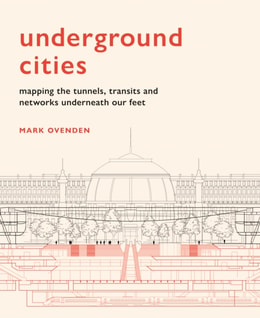
With over 60 per cent of the world's population living in cities, the networks beneath our feet which keep the cities above moving are more important than ever before.
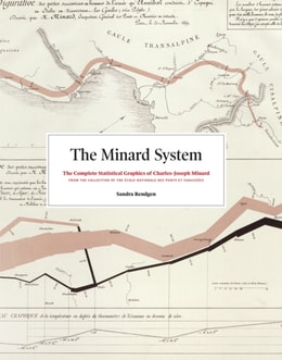
If you have any interest in information graphics, maps, or history, you know of the seminal flow map of Napoleon's 1812 march into Russia by Charles-Joseph Minard, made famous by Edward Tufte, and considered to be one of the most magnificent data graphics ever produced.
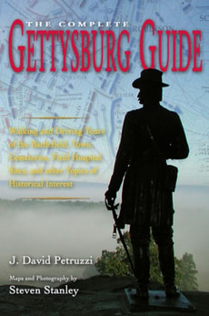
Winner for Reference, 2009, Army Historical Foundation Distinguished Book AwardHonorable Mention, 2010, Peter Seaborg Award Given by Shepherd UniversitySome two million people visit the battlefield at Gettysburg each year.
Integrating cutting-edge technology with traditional cartographic principles, this text provides a framework for effectively visualizing and analyzing geospatial data.
This concise, much-needed guide takes readers step by step through planning and executing field work associated with many different types of remote sensing projects.
This authoritative, reader-friendly text presents core principles of good map design that apply regardless of production methods or technical approach.
First place winner in Educational Products at the 2021 International Cartographic Conference Maps are ubiquitous, yet maps are not made equally, nor are they read equally.
The first single-project GIS textbook on the market, Understanding GIS: An ArcGIS Pro Project Workbook, third edition is an excellent resource for students and educators seeking a guide for an advanced, single-project-based course that incorporates GIS across a wide range of disciplines.