Maps have always been a fundamental tool in archaeological practice, and their prominence and variety have increased along with a growing range of digital technologies used to collect, visualise, query and analyse spatial data.
Maps have always been a fundamental tool in archaeological practice, and their prominence and variety have increased along with a growing range of digital technologies used to collect, visualise, query and analyse spatial data.
GlobalSoilMap: Digital Soil Mapping from Country to Globe contains contributions that were presented at the 2nd GlobalSoilMap conference, held 4-6 July 2017 in Moscow, Russian Federation.
GlobalSoilMap: Digital Soil Mapping from Country to Globe contains contributions that were presented at the 2nd GlobalSoilMap conference, held 4-6 July 2017 in Moscow, Russian Federation.
"e;Founded by the British Cartographic Society (BCS) and first published in June 1964, The Cartographic Journal was the first general distribution English language journal in cartography.
"e;Founded by the British Cartographic Society (BCS) and first published in June 1964, The Cartographic Journal was the first general distribution English language journal in cartography.
Throughout history, maps have been a powerful tool in the constitutive imaginary of governments seeking to define or contest the limits of their political reach.
Throughout history, maps have been a powerful tool in the constitutive imaginary of governments seeking to define or contest the limits of their political reach.
Medical geography is a fascinating area of rapidly evolving study that aims to analyse and improve worldwide health issues based on the geographical factors which have an impact on them.
Medical geography is a fascinating area of rapidly evolving study that aims to analyse and improve worldwide health issues based on the geographical factors which have an impact on them.
Addresses the fundamental principles of visual perception and map symbolism and critically examines the assumptions behind the theories of psychophysical testing and cartographic communication.
Addresses the fundamental principles of visual perception and map symbolism and critically examines the assumptions behind the theories of psychophysical testing and cartographic communication.
This book, first published in 1984, presents a series of analysis of colloquial spoken language, to illustrate some of the variety of phonological features of British English.
This book, first published in 1984, presents a series of analysis of colloquial spoken language, to illustrate some of the variety of phonological features of British English.
Although Cockney can be considered to be one of the most important non-standard forms of English, there had been little to no scholarly attention on the dialect prior to William Matthews's 1938 volume Cockney Past and Present.
Although Cockney can be considered to be one of the most important non-standard forms of English, there had been little to no scholarly attention on the dialect prior to William Matthews's 1938 volume Cockney Past and Present.
This book examines Felix Guattari, the French psychoanalyst, philosopher, and radical activist, renowned for an energetic style of thought that cuts across conceptual, political, and institutional spheres.
This book examines Felix Guattari, the French psychoanalyst, philosopher, and radical activist, renowned for an energetic style of thought that cuts across conceptual, political, and institutional spheres.
Davies examines how Renaissance illustrated maps shaped ideas about peoples of the Americas, revealing relationships between civility, savagery and monstrosity.
Davies examines how Renaissance illustrated maps shaped ideas about peoples of the Americas, revealing relationships between civility, savagery and monstrosity.
The Atlas of African Affairs is divided into five sections dealing with environmental, historical, political and economic issues and with Southern Africa.
The Atlas of African Affairs is divided into five sections dealing with environmental, historical, political and economic issues and with Southern Africa.
The new edition of the atlas (first published as The Atlas of Apartheid) presents a comprehensive introduction and detailed analysis of the spatial impact of apartheid in South Africa.
The new edition of the atlas (first published as The Atlas of Apartheid) presents a comprehensive introduction and detailed analysis of the spatial impact of apartheid in South Africa.
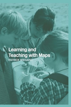
A comprehensive and authoritative account of how primary school children and teachers can use maps to enhance learning and deepen understanding of this essential skill.
A comprehensive and authoritative account of how primary school children and teachers can use maps to enhance learning and deepen understanding of this essential skill.