Noise mapping is the first tool to effectively assess noise exposure, communicating information to citizens, and defining effective action plans for protecting citizens from high noise levels and preserving quiet areas in urban European Community environments.
South and Southeast Asian countries are experiencing rapid land cover and land use changes (LCLUC) due to urbanization, agricultural expansion, deforestation, and infrastructure development.
This two-volume set CCIS 961 and 962 constitutes the refereed post-conference proceedings of the First International Conference on Transdisciplinary Multispectral Modeling and Cooperation for the Preservation of Cultural Heritage, TMM_CH 2018, held in Athens, Greece, in October 2018.
This book provides comprehensive and in-depth explanations of all topics related to quantitative remote sensing and its applications in terrestrial, biospheric, hydrospheric, and atmospheric studies.
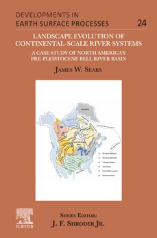
Landscape Evolution of Continental-Scale River Systems: A Case Study of North America's Pre-Pleistocene Bell River Basin provides a detailed case study and complete analysis of this continental-scale North American paleo-river system.
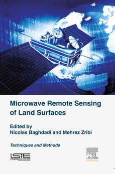
Microwave Remote Sensing of Land Surface: Techniques and Methods brings essential coverage of the space techniques of observation on continental surfaces.
This comprehensive textbook identifies the emerging legal, policy, and ethical considerations associated with the collection, analysis, storage, and distribution of data that can be tied to location on Earth - otherwise known as "e;geospatial information.
Remote Sensing of Geomorphology, Volume 23, discusses the new range of remote-sensing techniques (lidar, structure from motion photogrammetry, advanced satellite platforms) that has led to a dramatic increase in terrain information, and as such provided new opportunities for a better understanding of surface morphology and related Earth surface processes.
Spatiotemporal Analysis of Air Pollution and Its Application in Public Health reviews, in detail, the tools needed to understand the spatial temporal distribution and trends of air pollution in the atmosphere, including how this information can be tied into the diverse amount of public health data available using accurate GIS techniques.
Ground based synthetic aperture radar (GB-SAR) is used to effectively mitigate natural disasters and monitor social infrastructure such as bridges, dams, and airport pavement surfaces.
The book introduces a variety of latest techniques designed to represent, enhance, and empower multi-disciplinary approaches of geographic information system (GIS), artificial intelligence (AI), deep learning (DL), machine learning, and cloud computing research in healthcare.
Volume V of theSix Volume Remote Sensing Handbook, Second Edition, is focused on the use of remote sensing technologies for studying water resources, including groundwater, floods, snow and ice, and wetlands.
The development of effective methodologies for the analysis of multi-temporal data is one of the most important and challenging issues that the remote sensing community will face in the next few years.
Written by leaders in the field of remote sensing information processing, this book covers the frontiers of remote sensors, especially with effective algorithms for signal/image processing and pattern recognition with remote sensing data.
The development of effective methodologies for the analysis of multi-temporal data is one of the most important and challenging issues that the remote sensing community will face in the coming years.
This book uniquely bridges the conceptual gap between the history of geographic, cartographic thought, and film theory with the technological and cultural shifts that shaped the emergence of cameras and cinema.
This book presents a survey, dynamic monitoring and comprehensive analysis of Sri Lanka's land, vegetation, surface water, ocean and other environmental resources, as well as its economic, transportation, urban, agricultural and tourism development.
The Bay of Bengal is prone to tropical cyclones and storm surges as a result of its location, and many of the mostly poor people living along the coastal regions of South Asia lose their lives almost every year.
The book introduces a variety of latest techniques designed to represent, enhance, and empower multi-disciplinary approaches of geographic information system (GIS), artificial intelligence (AI), deep learning (DL), machine learning, and cloud computing research in healthcare.
The management of data to understand complex and interwoven processes of sustainable development has been a great challenge for researchers, planners, and decision makers.
Geospatial technology is a combination of state-of-the-art remote sensing and technology for geographic information systems (GIS) and global navigation satellite systems (GNSS) for the mapping and monitoring of landscapes and environment.
This book comprises the select peer-reviewed papers presented at the 7th Indian Young Geotechnical Engineers Conference (7IYGEC 2019) held at the National Institute of Technology, Silchar.
This book provides a comprehensive introduction about recent state-of-the-art advancements in Open GIS, including Open GIS data, services, software, and libraries for GIS programming.
Neural networks as the commonly used machine learning algorithms, such as artificial neural networks (ANNs) and convolutional neural networks (CNNs), have been extensively used in the GIScience domain to explore the nonlinear and complex geographic phenomena.
Globally, concerns for the environment and human well-being have increased as results of threats imposed by climate change and disasters, environmental degradation, pollution of natural resources, water scarcity and proliferation of slums.
The book addresses the rapid shifts which have taken place within cartography, and argues that no amount of technological sophistication will lead to neutral representations, and that as such critical cartography provides a solid foundation for questioning the power of maps.
This book reviews and summarizes the development and achievement in cartography and geographic information engineering in China over the past 60 years after the founding of the People's Republic of China.
This book focuses on the survey technology, post-processing technology, mapping technology and scientific application of the submarine topography and geomorphology in detail.