Statistical Geoinformatics for Human Environment Interface presents two paradigms for studying both space and interface with regard to human/environment: localization and multiple indicators.
Over the last 25 years, the "e;Africa Rising"e; discourse has been used to signify hope and promise for the continent, marking a break from previous pessimistic portrayals.
This book provides a groundbreaking exploration of satellite remote sensing's role in tracking the mobility and spread of COVID-19, focusing on its origin in Wuhan City.
A balanced review of differing approaches based on remote sensing tools and methods to assess and monitor biodiversity, carbon and water cycles, and the energy balance of terrestrial ecosystem.
The TransNav 2011 Symposium held at the Gdynia Maritime University, Poland in June 2011 has brought together a wide range of participants from all over the world.
A complete introductory text on an increasingly popular subject, "e;Geology and Environment in Britain and Ireland"e; aims to provide suitably broad coverage for students requiring a treatment clearly foucused on familiar examples but retaining a global perspective.
This book explores one of the most pressing issues of our time: development, a concern that has persisted from the past century through to today, and is increasingly intertwined with challenges related to environmental sustainability and growing inequalities.
Geophysical and Astrophysical Convection collects important papers from an international group of the world's foremost researchers in geophysical and astrophysical convection to present a concise overview of recent thinking in the field.
The new and updated eighth edition of Political Geography once again shows itself fit to tackle a frequently and rapidly changing geopolitical landscape.
He explains by explaining the issue of population explosion as an expression coming from the West, suggesting that the abundance of offspring is a danger to Islamic countries, and that it is a bomb that will explode and destroy everything, shedding light on the West's statistics about the doubling of the population and its danger to all of humanity, because there is not enough for this increase, and the result will be a major disaster that must be stopped.
Offering all aspects of humidity measurement and instrumentation, this work includes rudiments and theory, common applications, advantages and limitations of frequently-used sensors and techniques, and guidelines for installation, maintenance and calibration.
This edited volume will take an expansive view of the "e;publicness"e; of both the policies and the effects related to migration, immigration, and refugees.
The Definitive Volume on Cutting-Edge Exploratory Analysis of Massive Spatial and Spatiotemporal DatabasesSince the publication of the first edition of Geographic Data Mining and Knowledge Discovery, new techniques for geographic data warehousing (GDW), spatial data mining, and geovisualization (GVis) have been developed.
The TransNav 2011 Symposium held at the Gdynia Maritime University, Poland in June 2011 has brought together a wide range of participants from all over the world.
The Routledge Handbook of Disaster Response and Recovery covers the two post-disaster stages of the disaster cycle and presents am extensive and cutting-edge overview of their many considerations.
Decolonising the Built Environment: Process, Product, and Pedagogy provides an important and much-needed comprehensive overview of how decolonisation is shaping the built environment in theory, in practice, and as a process/project today.
Latin American Geographies introduces student readers to cutting-edge scholarship on a range of topics from Indigenous geographies to sustainable development and dependency theory.
Tauchen Sie ein in die faszinierende Welt der Meeresriffe – die "Regenwälder der Meere", in denen sich biologische Vielfalt, geologische Pracht und ökologische Bedeutung vereinen.
Fondée dans le cadre de la Chaire "Interculturalités méditerranéennes", labélisée par l'UNESCO en 2023, la revue Médiations méditerranéennes est emblématique de la mission qu'elle veut remplir dans le champ des recherches et des études en rapport avec l'espace méditerranéen.
Liner notations for all the keys to the KingdomThis book represents an attempt describe and explain multidimensional constructed space which is an alternative dimension of earth.
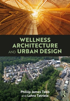
Wellness is a contemporary concept with deep ancient roots promoting preventative and holistic activities, lifestyle choices, and salient architecture and urban design practices.
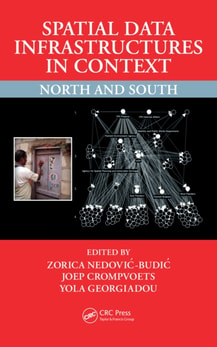
In the wake of the so-called information technology revolution, many stakeholders from the public and private sectors (including citizens) have indeed grown accustomed to the promise and usability of spatial data infrastructures (SDI) for data access, use, and sharing.
The Geography of the Port of London (1957) deals with the mid-century functions of the port studied in relation to their physical setting and in the light of their historical development.
This essential book offers suggestions for how cities and spaces can be planned and designed to reduce the impact of stress, provide opportunities for recovery, and promote the resilience of individuals in urban communities.
This volume analyses how visual and written narratives from Lusophone, or rather «Lusotopic», spaces – Portugal, Mozambique, East Timor and Goa – point to productive critical dialogues with the existing theories in Indian Ocean studies.
Spatial Data Science will show GIS scientists and practitioners how to add and use new analytical methods from data science in their existing GIS platforms.
Living with water brings together sociologists, geographers, artists, writers and poets to explore the ways in which water binds, immerses and supports us.
The book critically examines the epistemological disparities between colonialism and capitalism-critical cultural practices and Western art institutions.
This innovative and insightful book critically explores how to recognize and generate the social, cultural, political and economic values of the heritage of urban peripheries and encourage new metropolitan development scenarios that protect and build upon that cultural heritage.
In "Heimatlos: Die Geschichte der menschlichen Vertreibung" entführt Anke Weidel die Leser auf eine faszinierende und tiefgründige Reise durch die Jahrhunderte der menschlichen Geschichte, geprägt von Flucht und Vertreibung.
This multidisciplinary collection of scholarship rethinks European urban modernity from a race-conscious perspective, being aware of (post)colonial entanglements.
Explore the Important Role that the Semantics of Land Use and Land Cover Plays within a Broader Environmental ContextFocused on the information semantics of land use and land cover (LULC) and providing a platform for reassessing this field, Land Use and Land Cover Semantics: Principles, Best Practices, and Prospects presents a comprehensive overview of fundamental theories and best practices for applying semantics in LULC.
Over the last two decades there has been increasing recognition that problems in oceanography and fisheries sciences and related marine areas are nearly all manifest in the spatio-temporal domain.