The Countryside: Planning and Change (1981) examines the relationship between policies and their actual effects on the countryside, throwing light on the problems inherent in a fragmented approach to policy-making.
Building on an abolitionist perspective, this book offers an essential critique of migration and border policies, unsettling the distinction between migrants and citizens.
This book facilitates a critical investigation of gaps in theorizing and framing dark tourism by navigating through some onto-epistemological issues, theoretical entanglements, future possibilities, and the application of critical theoretical perspectives related to affect and emotions, human-animal studies, postcolonialism, feminism, trauma studies, posthumanism, power and identity.
Rock Mechanics & Strata Control: Theory, Practice, and Application serves as a practical guide for examining many of the fundamental and applied aspects of rock mechanics and strata control needed to help ensure safe and effective surface and underground mining.
In addition to being a fundamental concept for planning the water infrastructure which supports extensive agricultural economies across Southeast Asia, knowledge of the Mekong River's hydrological catchments has calibrated the control of land, resources and people.
Geographies of Journalism connects theoretical and practical discussions of the role of geotechnologies, social media, and boots-on-the-ground journalism in a digital age to underline the complications and challenges that place-making in the press brings to institutions and ideologies.
This book draws together interdisciplinary perspectives to examine the legal, moral, and socio-spatial regulation of sex work in the contemporary context.
Recent studies of Chinese voluntary associations (CVAs) have attempted to highlight the theoretical significance of CVAs for understandings of community (re)making.
This book includes evidence-based accounts of inequities in the arts as well as a focus on systems that perpetuate and resolve inequities in this context - a topic of wide interest to researchers and practitioners in arts and culture.
Regional technology-based economic development and the recruitment and retention of talent is a top priority of city-regions in the United States and in countries around the world.
This second edition focuses on Tropical Dry Forests (TDF) in the Americas and provides a comprehensive overview of new studies conducted in the last decade, giving new insights into the most endangered ecosystem in the tropics.
This book is a systematic monograph on urban space development theory, exploring the laws of urban space development and the basic principles of planning and design.
This book is a systematic monograph on urban space development theory, exploring the laws of urban space development and the basic principles of planning and design.
With the increasing proliferation of data and the systematization of geographic information referencing, maps are now a major concern not only for specialists, but also for urban planning and development organizations and the general public.
The Routledge Handbook of Field Research presents a comprehensive, go-to resource for staff and students in preparing for and thinking about the doing of field research, including both individual fieldwork and group field classes.
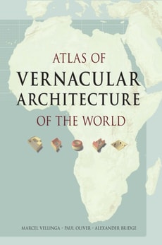
The first world atlas ever compiled on vernacular architecture, this comprehensive work illustrates the variety and ingenuity of the world's vernacular building traditions from a multi-disciplinary, cross-cultural and comparative approach, using over sixty world and regional maps.
The development of earth observation and computing technology has promoted the wide application of spatio-temporal big data and artificial intelligence.
The development of earth observation and computing technology has promoted the wide application of spatio-temporal big data and artificial intelligence.
This innovative Routledge Handbook sheds light on the complex and transformative nature of Global China, prompting a re- evaluation of existing theories on global and regional dynamics.
This book provides a comprehensive analysis of post-Games legacy governance including stakeholder relationships, institutional conditions, and policy environments, while also empirically exploring the modes of governance employed by select cases of the Winter Olympic Games.