Despite significant development in earthquake analysis and design in the last 50 years or more, different structures related to industry, infra structure and human habitats get destroyed with monotonic regularity under strong motion earthquake.
The study of disaster statistics and disaster occurrence is a complicated interdisciplinary field involving the interplay of new theoretical findings from several scientific fields like mathematics, physics, and computer science.
A comprehensive overview of glacially triggered faulting summarising theory, methods and modelling, and listing confirmed and proposed glacially induced faults.
This second edition was undertaken to update information which has become available since the first edition and to convert completely to the SI system.
Model Ecosystems in Extreme Environments, Second Edition examines ecosystems at the most extreme habitats and their interaction with the environment, providing a key element in our understanding of the role and function of microorganisms in nature.
This second edition of EPA's bestselling book, Description and Sampling of Contaminated Soils: A Field Guide, Second Edition, has been revised and significantly expanded over the original edition.
This book presents an easy-to-use tool for time series analysis and allows the user to concentrate upon studying time series properties rather than upon how to calculate the necessary estimates.
This volume presents recent developments in atmospheric sciences driven by numerical modeling which makes use of geospatial technologies and increasing computational power.
This landmark monograph presents the most recent mathematical developments in the analysis of ionospheric distortions of SAR images and offers innovative new strategies for their mitigation.
This book compares how seismic fault activation can be described by frictional-based theories such as the rate and state theory or by a general dynamic plasticity approach such as the Cam-Clay theory.
This accessible reference presents the evolution of concepts of time and methods of time keeping, for historians, scientists, engineers, and educators.
Python is used in a wide range of geoscientific applications, such as in processing images for remote sensing, in generating and processing digital elevation models, and in analyzing time series.
A new discipline of hydrogeophysics has evolved, aimed at improved simultaneous use of geophysical and hydrogeological measurements for hydrogeological investigations.
Written 10 years after the publication of the first edition, this updated edition of Real-Time Environmental Monitoring: Sensors and Systems introduces the fundamentals of environmental monitoring based on electronic sensors, instruments, systems, and software that allow continuous and long-term ecological and environmental data collection.
This book describes in detail the various theories on the shape of the Earth from classical antiquity to the present day and examines how measurements of its form and dimensions have evolved throughout this period.
A comprehensive and practical overview of the state of the science, Soil Quality Standards for Trace Elements: Derivation, Implementation, and Interpretation addresses the derivation of soil quality standards for trace elements and the implementation of these standards within regulatory and risk assessment frameworks.
GPS and GNSS Technology in Geosciences offers an interdisciplinary approach to applying advances in GPS/GNSS technology for geoscience research and practice.
This volume contains the most relevant peer-reviewed papers presented at The First International Workshop on Vrancea Earthquakes, held in Bucharest on November 1-4, 1997.
Adopting a global approach, this unique book provides an updated review of the geology of Iberia and its continental margins from a geodynamic perspective.
These Proceedings are published to give a full account of the Fifth International Conference on Atmospheric Electricity held in September 1974 in Garmisch-Partenkirchen in the Bavarian Alps in Germany.
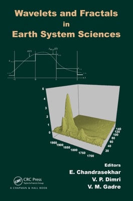
The subject of wavelet analysis and fractal analysis is fast developing and has drawn a great deal of attention in varied disciplines of science and engineering.
A wondrous story of scientific endeavorprobing the great ice sheets of AntarcticaFrom the moment explorers set foot on the ice of Antarctica in the early nineteenth century, they desired to learn what lay beneath.
The collapse of the Soviet Union has seen the emergence of its unprecedentedly comprehensive global secret military mapping project and the commercial availability of a vast number of detailed topographic maps and city plans at several scales.
This book collects the papers presented at the 7th International Conference on Risk Analysis and Crisis Response (RACR-2019) held in Athens, Greece, on October 15-19, 2019.
In a world of growing complexity and dwindling resources, the relationship between technology and sustainability is a pressing issue of concern at the highest levels.
Homeland Security: An Introduction to Principles and Practice, Fourth Edition continues its record of providing a fully updated, no-nonsense textbook to reflect the latest policy, operational, and program changes to the Department of Homeland Security (DHS) over the last several years.
This book corresponds to the fifth volume of the series focused on Processes in GeoMedia and their research on the dynamic of natural systems, including theoretical and experimental studies of the processes occurring in the earth's bowels, the ocean, and the atmosphere.