Volume IV of the Six Volume Remote Sensing Handbook, Second Edition, is focused on the use of remote sensing in forestry, biodiversity, ecology, land use and land cover, and global terrestrial carbon mapping and monitoring.
Ground based synthetic aperture radar (GB-SAR) is used to effectively mitigate natural disasters and monitor social infrastructure such as bridges, dams, and airport pavement surfaces.
This book contains a selection of the best articles presented at the 4th International Conference GIRE3D - Participatory and Integrated Management of Water Resources in Arid Zones, November 23th-25th , Help at Laayoune - Morocco, co-organized by Moroccan Committee of the International Hydraulics Association (CM-AIH) and Hydraulic basin agency of Sakia El Hamra and Oued Eddahab (ABHSHOD).
The primary aim of this edited volume is to document the current theories, best practices, and technological advancements in the move towards a Smart Built Environment (SBE).
Remote Sensing of Impervious Surfaces in Tropical and Subtropical Areas offers a complete and thorough system for using optical and synthetic aperture radar (SAR) remote sensing data for improving impervious surface estimation (ISE).
Volume VI of the Six Volume Remote Sensing Handbook, Second Edition, is focused on the use of remote sensing in the assessment and monitoring of droughts, dry lands, biomass burning, disasters such as volcanoes and fires, and urban studies and nightlights.
Geographical information systems (GIS) are powerful tools for reporting on the environment, natural resources and social and economic development; modelling the environmental, biophysical, social and economic processes; assessing environmental and social impacts; evaluating environmental, social and economic policies and actions and dissimilating spatial information.
The Urban Data Management Society has organised international symposia at various locations throughout Europe since 1971, and UDMS 2013 marks its second visit to London.
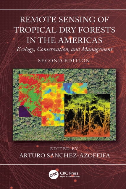
This second edition focuses on Tropical Dry Forests (TDF) in the Americas and provides a comprehensive overview of new studies conducted in the last decade, giving new insights into the most endangered ecosystem in the tropics.
The development of earth observation and computing technology has promoted the wide application of spatio-temporal big data and artificial intelligence.
The development of earth observation and computing technology has promoted the wide application of spatio-temporal big data and artificial intelligence.
This work addresses the whole range of problems relating to the application of satellite technology to studies of regional seas and sea phenomona - the Gulf Stream, the Kuroshia Current - and coastal zones.
Although lunar exploration began in the 1960s, the moon and other planets have many long-standing, unanswered questions about planetary environments, origin, formation and evolution, magnetization of crustal rocks, internal structure, and possible life.
Volume III of the Six Volume Remote Sensing Handbook, Second Edition, is focused on agriculture; food security; vegetation; phenology; rangelands; soils; and global biomass modeling, mapping, and monitoring using multi-sensor remote sensing.
Since the launch of the first of the Advanced Very High Resolution Radiometers (AVHRRs) in 1978, the data from these instruments has used for a wide range of non-meteorological applications.
The focal main objective of the book is to constitute a meaningful linkage among research problems, geoinformation methods and corresponding applications.
This book comprises the contributions of the African Association of Remote Sensing of the Environment (AARSE) international conference which is conducted biennially across Africa, alternately with the AfricaGIS conference.
This book comprises the contributions of the African Association of Remote Sensing of the Environment (AARSE) international conference which is conducted biennially across Africa, alternately with the AfricaGIS conference.
Python is used in a wide range of geoscientific applications, such as in processing images for remote sensing, in generating and processing digital elevation models, and in analyzing time series.
Python is used in a wide range of geoscientific applications, such as in processing images for remote sensing, in generating and processing digital elevation models, and in analyzing time series.
This second edition focuses on Tropical Dry Forests (TDF) in the Americas and provides a comprehensive overview of new studies conducted in the last decade, giving new insights into the most endangered ecosystem in the tropics.
Volume VI of the Six Volume Remote Sensing Handbook, Second Edition, is focused on the use of remote sensing in the assessment and monitoring of droughts, dry lands, biomass burning, disasters such as volcanoes and fires, and urban studies and nightlights.
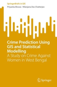
The study presented in this SpringerBrief uses GIS tools to analyze incidents of violence against women in West Bengal India, identifying "e;hotspots"e; and offering tools and strategies to predict and prevent future violence.
A revision of Openshaw and Abrahart's seminal work, GeoComputation, Second Edition retains influences of its originators while also providing updated, state-of-the-art information on changes in the computational environment.
The study presented in this SpringerBrief uses GIS tools to analyze incidents of violence against women in West Bengal India, identifying "e;hotspots"e; and offering tools and strategies to predict and prevent future violence.
This text reflects the interdisciplinary nature of GIS research and includes coverage of such themes as: virtual GIS; spatial analysis; artificial intelligence; spatial agents and fuzzy systems; and space-time GIS and GIS applications.
Volume V of theSix Volume Remote Sensing Handbook, Second Edition, is focused on the use of remote sensing technologies for studying water resources, including groundwater, floods, snow and ice, and wetlands.
This book aims to summarize and report the major research achievements and validation results under the global land cover (GLC) initiative led by the Group Earth Observation (GEO).
Radar Hydrology: Principles, Models, and Applications provides graduate students, operational forecasters, and researchers with a theoretical framework and practical knowledge of radar precipitation estimation.