This accessible shortform book describes storm surge forecasting to enable port managers and practitioners to forecast these and mitigate their effects.
Geospatial tools to Groundwater Resources explain the most recent methods in Geographic Information Systems (GIS) and geostatistics as they apply to groundwater through complete case studies that demonstrate actual remote sensing applications in this field.
This new edition introduces the fundamentals of passive microwave remote sensing of oceans, including the physical principles of microwave radiometry, novel observational data, their interpretation, and applications.
The Asia-Pacific region, home to some of the world's fastest-growing economies, faces a range of complex challenges, including environmental degradation, the increasing frequency of natural hazards, and rapid urbanization.
Injuries due to air turbulence has increased recently, therefore there is considerable concern and interest in understanding and detecting it more accurately.
This volume gathers the latest advances, innovations, and applications in the field of GIS and geo-spatial technologies, as presented by leading researchers and engineers at the International Conference on Geoinformatics for Spatial-Infrastructure Development in Earth & Allied Sciences (GIS-IDEA), held in Hanoi, Vietnam on November 7-9 2023.
This volume gathers the latest advances, innovations, and applications in the field of GIS and geo-spatial technologies, as presented by leading researchers and engineers at the International Conference on Geoinformatics for Spatial-Infrastructure Development in Earth & Allied Sciences (GIS-IDEA), held in Hanoi, Vietnam on November 7-9 2023.
More than 50% of the world's population already live in cities, and the proportion is rising extremely rapidly towards developed country levels of more than 90%.
Geodesign, Urban Digital Twins, and Futures explores systems, processes, and novel technologies for planning, mapping, and designing our built environment.
Keine ausführliche Beschreibung für "Das abgekürzte Eggert’sche Verfahren zum Ausgleichen grosser geodätischer Systeme nach der Methode der kleinsten Quadrate" verfügbar.
Der neueste Stand der Forschung und Entwicklung auf dem Gebiet der Umweltinformatik (UI) und umweltbezogener IT-Anwendungsbereiche wird in diesem Tagungsband präsentiert und kritisch diskutiert.
Der neueste Stand der Forschung und Entwicklung auf dem Gebiet der Umweltinformatik (UI) und umweltbezogener IT-Anwendungsbereiche wird in diesem Tagungsband präsentiert und kritisch diskutiert.
The objective of this publication is to provide insight into advancing remote sensing techniques dealing with floods, droughts, landslides, earthquakes, permafrost-related hazards, glacial lake outburst floods, forest fires, droughts, tropical cyclones, climate resilience and COVID-19.
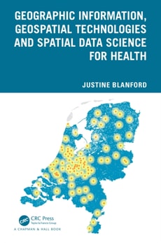
Geographic information, spatial analysis and geospatial technologies play an important role in understanding changes in planetary health and in defining the drivers contributing to different health outcomes both locally and globally.
Lunar explorations have received increasing attention in recent years with tremendous application values, including using the Moon as a remote sensing platform for Earth observation.
The Routledge Handbook of Cartographic Humanities offers a vibrant exploration of the intersection and convergence between map studies and the humanities through the multifaceted traditions and inclinations from different disciplinary, geographical and cultural contexts.
This book contains a selection of the best articles presented at the 4th International Conference GIRE3D - Participatory and Integrated Management of Water Resources in Arid Zones, November 23th-25th , Help at Laayoune - Morocco, co-organized by Moroccan Committee of the International Hydraulics Association (CM-AIH) and Hydraulic basin agency of Sakia El Hamra and Oued Eddahab (ABHSHOD).
Die Geschichte von Atlantis – eine sagenumwobene Insel, die von einer fortschrittlichen Zivilisation bewohnt und durch eine Katastrophe zerstört wurde – fasziniert und inspiriert die Menschheit seit mehr als zweitausend Jahren.
The fifth edition of this core textbook in advanced remote sensing continues to maintain its emphasis on statistically motivated, data-driven techniques for remote sensing image analysis.
Environment as a Weapon considers how the confluence of war and nature from the time of the Agricultural Revolution (10,000 BCE) to our present day has been represented in works of history, geography, and literature.
Environment as a Weapon considers how the confluence of war and nature from the time of the Agricultural Revolution (10,000 BCE) to our present day has been represented in works of history, geography, and literature.
This book aims to provide a wide range of real-world applications in using unmanned aerial vehicles (UAVs) for geographic observation, spatial modeling, and urban informatics.
This book aims to provide a wide range of real-world applications in using unmanned aerial vehicles (UAVs) for geographic observation, spatial modeling, and urban informatics.
Landscape Evolution of Continental-Scale River Systems: A Case Study of North America's Pre-Pleistocene Bell River Basin provides a detailed case study and complete analysis of this continental-scale North American paleo-river system.
Polar Ice and Global Warming in Cryosphere Regions is based on recent and past climate variabilities data gathered through satellites and spatial-temporal analysis to explain the role of global warming on cryosphere regions such as high-latitude Himalaya, Arctic and Antarctic regions, and the surrounding Southern Ocean and Arctic Ocean.
Volume III of the Six Volume Remote Sensing Handbook, Second Edition, is focused on agriculture; food security; vegetation; phenology; rangelands; soils; and global biomass modeling, mapping, and monitoring using multi-sensor remote sensing.
Advances in Web-based GIS, Mapping Services and Applications is published as part of ISPRS WG IV/5 effort, and aims at presenting (1) Recent technological advancements, e.
This book exposes practitioners and decision-makers to the theory and application of river ice processes to gain a better understanding of these processes for modelling and ice flood hazard and risk assessment.
This book exposes practitioners and decision-makers to the theory and application of river ice processes to gain a better understanding of these processes for modelling and ice flood hazard and risk assessment.
This book describes the most recent strategies for the digitalization of railway sector that bring new challenges for the construction, operation, and maintenance of railway infrastructures.
This book describes the most recent strategies for the digitalization of railway sector that bring new challenges for the construction, operation, and maintenance of railway infrastructures.
Advances in artificial intelligence (AI), widespread mobile devices, internet technologies, multimedia data sources, and information processing have led to the emergence of multimedia processing.