Following two successful editions, the third edition of GIS: A Computing Perspective has been completely revised and updated, with extensive new content reflecting the significant progress that has been made in the realm of GIS within the last 20 years.
Following two successful editions, the third edition of GIS: A Computing Perspective has been completely revised and updated, with extensive new content reflecting the significant progress that has been made in the realm of GIS within the last 20 years.
In today's world, organizations face a multitude of problems that require an unprecedented need for tools to share information and work better together.
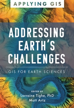
This book presents landslide studies using the geographic information system (GIS), which includes not only the science of GIS and remote sensing, but also technical innovations, such as detailed light detection and ranging profiles, among others.
This book provides an assessment of the impacts of human intervention on the natural environment and peoples' livelihoods through land-use conversion due to industrialization.
This book, with contributions from leading academics - and including reviews and case studies from Ethiopian Church forests - provides a valuable reference for advanced students and researchers interested in forest and other natural resource management, ecology and ecosystem services as well as restoration options.
The book addresses the rapid shifts which have taken place within cartography, and argues that no amount of technological sophistication will lead to neutral representations, and that as such critical cartography provides a solid foundation for questioning the power of maps.
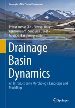
This volume provides a versatile introduction to the study of drainage basin evolution, morphology, drainage basin hydrology and sedimentology, human interference, natural and anthropogenic hazards and various management techniques.
This book focuses on the survey technology, post-processing technology, mapping technology and scientific application of the submarine topography and geomorphology in detail.
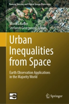
According to UN estimates, approximately nearly half of the world's population now lives in cities and that figure is expected to rise to almost 70% by 2050.
This book deals with three different subjects: geography, social media and religion equally to discuss e-religiosity in terms of screenscapes that shaped digital socialization processes wherein the role of digital devices in general and smartphones in particular are considered crucial and critical.
The recent emergence and widespread use of remote sensing and geographic information systems (GIS) has prompted new interest in scale as a key component of these and other geographic information technologies.
The recent emergence and widespread use of remote sensing and geographic information systems (GIS) has prompted new interest in scale as a key component of these and other geographic information technologies.
Advanced GIS and Crime Analysis explores the existing spatial variability of crime committed against women in West Bengal and steadily excavates the underlying determinants accountable for specific crimes against women.
This book elaborates fuzzy machine and deep learning models for single class mapping from multi-sensor, multi-temporal remote sensing images while handling mixed pixels and noise.
This book elaborates fuzzy machine and deep learning models for single class mapping from multi-sensor, multi-temporal remote sensing images while handling mixed pixels and noise.
This contributed volume presents relevant examples of socio-environmental research that highlight the challenges and opportunities of using geotechnologies in interdisciplinary settings across the vast, culturally, and environmentally mega-diverse region known as Latin America.
This book presents a systematic analysis of challenges in the field of Geographical Information Systems and Science, geographical analysis, and regional science for Ontario, one of the fastest-changing provinces in Canada and one of North America's largest economic hubs.
Der neueste Stand der Forschung und Entwicklung auf dem Gebiet der Umweltinformatik (UI) und umweltbezogener IT-Anwendungsbereiche wird in diesem Tagungsband präsentiert und kritisch diskutiert.
This book presents a systematic analysis of challenges in the field of Geographical Information Systems and Science, geographical analysis, and regional science for Ontario, one of the fastest-changing provinces in Canada and one of North America's largest economic hubs.
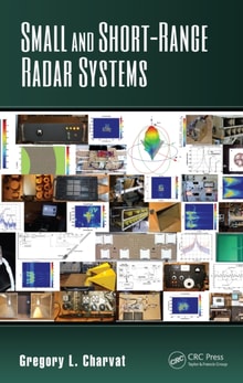
This book provides basic and advanced concepts of synthetic aperture radar (SAR), PolSAR, InSAR, PolInSAR, and all necessary information about various applications and analysis of data of multiple sensors.
This book provides basic and advanced concepts of synthetic aperture radar (SAR), PolSAR, InSAR, PolInSAR, and all necessary information about various applications and analysis of data of multiple sensors.
This book gives readers a practical introduction into machine learning and sensing techniques, their design and ultimately specific applications that could improve food production.
This book gives readers a practical introduction into machine learning and sensing techniques, their design and ultimately specific applications that could improve food production.
This volume gathers the latest advances, innovations, and applications in the field of geographic information systems and unmanned aerial vehicle (UAV) technologies, as presented by leading researchers and engineers at the 2nd International Conference on Unmanned Aerial System in Geomatics (UASG), held in Roorkee, India on April 2-4, 2021.
Originally published in 1980, this book draws together a wide range of studies dealing with various aspects of land use in a text specifically designed to guide students through the complexities of the subject.
Originally published in 1980, this book draws together a wide range of studies dealing with various aspects of land use in a text specifically designed to guide students through the complexities of the subject.
This book presents a select set of papers from an international and multidisciplinary approach, outlining the vanguard in the field of methodology, tools, and evaluation of the movement towards urban resilience.