Modern land administration applies geospatial thinking to better understand and plan the proper use, conservation, and equitable use of land and property.
The definitive guide to analysis techniques for examining the geography of crime Understanding Crime: Analyzing the Geography of Crime delves into both theory and technique to explain the geographic analysis of crime.
The world faces challenges that supersede and ignore national and regional boundaries and cannot be solved by a single individual, nation, science, or profession.
GIS for Science, Volume 3: Maps for Saving the Planet, highlights real-world examples of scientists creating maps about saving life on Earth and preserving biodiversity.
Foreword by Jane Goodall Thirty inspiring stories of diverse women using geospatial technology to advance science and help resolve important issues facing the world.
Merging the rigor of the scientific method with the technologies of GIS GIS for Science, Volume 2: Applying Mapping and Spatial Analytics brings to life a continuing collection of current, real-world examples of scientists using geographic information systems (GIS) and spatial data science to expand our understand of the world.
The first single-project GIS textbook on the market, Understanding GIS: An ArcGIS Pro Project Workbook, third edition is an excellent resource for students and educators seeking a guide for an advanced, single-project-based course that incorporates GIS across a wide range of disciplines.
Focus on Geodatabases in ArcGIS Pro introduces readers to the geodatabase, the comprehensive information model for representing and managing geographic information across the ArcGIS platform.
The third book in the Making Spatial Decisions series, Making Spatial Decisions Using GIS and Lidar, focuses on scenario-based problem solving using an integrated workflow in ArcGIS for Desktop.
Advanced Land-Use Analysis for Regional Geodesign: Using LUCISplus is the follow-up book to Smart Land-Use Analysis: The LUCIS Model (Esri Press 2007).
Citizen Planners: Shaping Communities with Spatial Tools describes how geographic information systems can be made accessible to ordinary citizens with little or no professional training to help plan and shape their local communities.
Mapping and Modeling Weather and Climate with GIS is a contributed volume of 23 chapters from leading climatologists, meteorologists, and other experts about how geospatial cartography and analysis helps to advance atmospheric science research.
GIS Research Methods: Incorporating Spatial Perspectives shows researchers how to incorporate spatial thinking and geographic information system (GIS) technology into research design and analysis.
GIS Tutorial for Python Scripting uses practical examples, exercises, and assignments to help students develop proficiency using Python(R) in ArcGIS(R) GIS Tutorial for Python builds upon previously acquired GIS skills and takes them to the next level with the use of Python.
Getting to Know Web GIS, a workbook with detailed, step-by-step exercises, teaches readers how to share resources online and build web GIS applications easily and quickly.
Thinking About GIS: Geographic Information System Planning for Managers presents a planning model for designing data and technology systems that will meet any organization's specific needs.
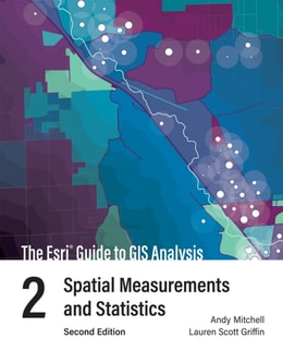
The Esri Guide to GIS Analysis, Volume 3: Modeling Suitability, Movement, and Interaction describes practical applications of modeling concepts in a geographic information system (GIS).
Lining Up Data in ArcGIS: A Guide to Map Projections is an easy-to-navigate, troubleshooting reference for any GIS user with the common problem of data misalignment.