Designing Geodatabases for Transportation addresses the construction of a GIS to manage data describing the transportation facilities and services commonly organized around various modes of travel.
Citizen Planners: Shaping Communities with Spatial Tools describes how geographic information systems can be made accessible to ordinary citizens with little or no professional training to help plan and shape their local communities.
This book is based on satellite image processing, focusing on the potential of hyperspectral image processing (HIP) research with a case study-based approach.
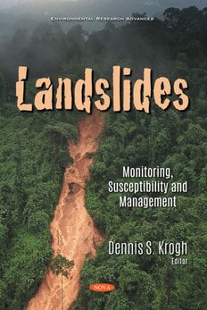
Landslides: Monitoring, Susceptibility and Management opens with a presentation of the application of geographic information system -based statistical modeling in the delineation of landslide susceptible zones for Rani Khola River basin of Sikkim Himalayas, India, by combining various landslide conditioning factors, namely: geological, topographical and hydrological parameters.
Geographic Information Systems (GIS) play a pivotal role in the field of urban planning and management and provide better solutions for numerous urban problems.
Geographic Information Systems (GIS) play a pivotal role in the field of urban planning and management and provide better solutions for numerous urban problems.
This is the first comprehensive international atlas featuring all ecological services provided by Ramsar wetlands, with complete views of all Ramsar sites, through remote sensing and mapping.
Through interaction with other databases such as social media, geographic information systems have the ability to build and obtain not only statistics defined on the flows of people, things, and information but also on perceptions, impressions, and opinions about specific places, territories, and landscapes.
Future remote sensing systems will make extensive use of Compressive Sensing (CS) as it becomes more integrated into the system design with increased high resolution sensor developments and the rising earth observation data generated each year.
In the last few years the scientific community has realized that obtaining a better understanding of interactions between natural systems and the man-made environment across different scales demands more research efforts in remote sensing.
Topographic Laser Ranging and Scanning, Second Edition, provides a comprehensive discussion of topographic LiDAR principles, systems, data acquisition, and data processing techniques.
Many disciplines are concerned with manipulating geometric (or spatial) objects in the computer - such as geology, cartography, computer aided design (CAD), etc.
This book provides the practical basis for the use of remote sensing to accomplish landscape ecological projects, through the merging of theory and practice, with examples.
Satellite remote sensing, in particular by radar altimetry, is a crucial technique for observations of the ocean surface and of many aspects of land surfaces, and of paramount importance for climate and environmental studies.
Environmental remote sensing plays a critical role in observing key hydrological components such as precipitation, soil moisture, evapotranspiration and total water storage on a global scale.
Remote Sensing Image Fusion: A Practical Guide gives an introduction to remote sensing image fusion providing an overview on the sensors and applications.
This book explores the applicability of multiple remote sensors to acquire information relevant to restoration and conservation efforts in wetlands using data collected from airborne and space multispectral/hyperspectral sensors, light detection and ranging (LiDAR), Unmanned Aircraft Systems (UAS), and a hand-held spectroradiometer.
Driven by the societal needs and improvement in sensor technology and image processing techniques, remote sensing has become an essential geospatial tool for understanding the Earth and managing Human-Earth interactions.
The Asia-Pacific region, home to some of the world's fastest-growing economies, faces a range of complex challenges, including environmental degradation, the increasing frequency of natural hazards, and rapid urbanization.
This SpringerBrief presents the fundamental concepts of a specialized class of data stream, spatio-temporal data streams, and demonstrates their distributed processing using Big Data frameworks and platforms.
This SpringerBrief details the MESSENGER Mission, the findings of which present challenges to widely held conventional views and remaining mysteries surrounding the planet.
This SpringerBrief provides a general overview of the role of satellite applications for disaster mitigation, warning, planning, recovery and response.
Applications of Remote Sensing in Agriculture contains the proceedings of the 48th Easter School in Agricultural Science, held at the University of Nottingham on April 3-7, 1989.
This work addresses the whole range of problems relating to the application of satellite technology to studies of regional seas and sea phenomona - the Gulf Stream, the Kuroshia Current - and coastal zones.