Geographic information systems have developed rapidly in the past decade, and are now a major class of software, with applications that include infrastructure maintenance, resource management, agriculture, Earth science, and planning.
The ability to extract generic 3D objects from images is a crucial step towards automation of a variety of problems in cartographic database compilation, industrial inspection and assembly, and autonomous navigation.
In recent years, the conservation of tropical forests has received worldwide publicity whereas effective forest management, particularly for timber extraction, has attracted little attention and gained some notoriety.
Mining Spatio-Temporal Information Systems, an edited volume is composed of chapters from leading experts in the field of Spatial-Temporal Information Systems and addresses the many issues in support of modeling, creation, querying, visualizing and mining.
Linking People, Place, and Policy: A GIScience Approach describes a breadth of research associated with the study of human-environment interactions, with particular emphasis on land use and land cover dynamics.
Remote Sensing of Forest Environments: Concepts and Case Studies is an edited volume intended to provide readers with a state-of-the-art synopsis of the current methods and applied applications employed in remote sensing the world's forests.
The rate at which geospatial data is being generated exceeds our computational capabilities to extract patterns for the understanding of a dynamically changing world.
This brief provides an overview of state-of-the-art sensing technologies relevant to the problem of precision irrigation, an emerging field within the domain of precision agriculture.
Quo Vadis: Evolution of Modern Navigation presents an intelligent and intelligible account of the essential principles underlying the design of satellite navigational systems-with introductory chapters placing them in context with the early development of navigational methods.
Whereas conventional maps can be expressed as outward-expanding formulae with well-defined central features and relatively poorly defined edges, Constant Scale Natural Boundary (CSNB) maps have well-defined boundaries that result from natural processes and thus allow spatial and dynamic relationships to be observed in a new way useful to understanding these processes.
By introducing Semantic Web technologies into geospatial Web services, this book addresses the semantic description of geospatial data and standards-based Web services, discovery of geospatial data and services, and generation of composite services.
Historical archives of vertical photographs and satellite images acquired for other purposes (mainly declassified military reconnaissance) offer considerable potential for archaeological and historical landscape research.
Remote Sensing provides information on how remote sensing relates to the natural resources inventory, management, and monitoring, as well as environmental concerns.
Imagine yourself as a military officer in a conflict zone trying to identify locations of weapons caches supporting road-side bomb attacks on your country's troops.
Every amateur astronomer has at least heard of the many different catalogs of deep-sky objects; the most well known are the Messier, the Caldwell, the Herschel, and the NGC.
Until the publication of the first edition of 'Star Maps,' books were either general histories of astronomy using examples of antiquarian celestial maps as illustrations, or catalogs of celestial atlases that failed to trace the flow of sky map development over time.
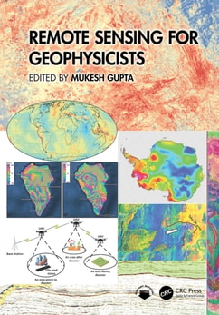
Remote sensing has witnessed a renaissance as new sensor systems, data collection capabilities and image processing methodologies have expanded the technological capabilities of this science into new and important applications areas.
Deep Learning for Multi-Sensor Earth Observation addresses the need for transformative Deep Learning techniques to navigate the complexity of multi-sensor data fusion.
This comprehensive handbook covers Geospatial Artificial Intelligence (GeoAI), which is the integration of geospatial studies and AI machine (deep) learning and knowledge graph technologies.
Hyperspectral Imaging: Techniques for Spectral Detection and Classification is an outgrowth of the research conducted over the years in the Remote Sensing Signal and Image Processing Laboratory (RSSIPL) at the University of Maryland, Baltimore County.
Methods and Materials for Remote Sensing: Infrared Photo-Detectors, Radiometers and Arrays presents the basic principles and the guidelines for the design of IR and microwave radiometers intended for the detection of weak electromagnetic signals in a noisy background.
Statistical Processing Techniques for Noisy Images presents a statistical framework to design algorithms for target detection, tracking, segmentation and classification (identification).
Earth Observation interacts with space, remote sensing, communication, and information technologies, and plays an increasingly significant role in Earth related scientific studies, resource management, homeland security, topographic mapping, and development of a healthy, sustainable environment and community.