Remote Sensing Applications in Environmental and Earth System Sciences is a contemporary, multi-disciplinary, multi-scaling, updated, and upgraded approach of applied remote sensing in the environment.
The Sendai Framework for Disaster Risk Reduction 2015-2030 has identified four priority areas for Disaster Risk Reduction: understanding disaster risk; strengthening disaster risk governance to manage disaster risk; investing in disaster risk reduction for resilience and enhancing disaster preparedness for effective response; and to "e;Build Back Better"e; in recovery, rehabilitation and reconstruction.
The Sendai Framework for Disaster Risk Reduction 2015-2030 has identified four priority areas for Disaster Risk Reduction: understanding disaster risk; strengthening disaster risk governance to manage disaster risk; investing in disaster risk reduction for resilience and enhancing disaster preparedness for effective response; and to "e;Build Back Better"e; in recovery, rehabilitation and reconstruction.
Written by leading global experts, including pioneers in the field, the four-volume set on Hyperspectral Remote Sensing of Vegetation, Second Edition, reviews existing state-of- the-art knowledge, highlights advances made in different areas, and provides guidance for the appropriate use of hyperspectral data in the study and management of agricultural crops and natural vegetation.
Written by leading global experts, including pioneers in the field, the four-volume set on Hyperspectral Remote Sensing of Vegetation, Second Edition, reviews existing state-of- the-art knowledge, highlights advances made in different areas, and provides guidance for the appropriate use of hyperspectral data in the study and management of agricultural crops and natural vegetation.
Written by leading global experts, including pioneers in the field, the four-volume set on Hyperspectral Remote Sensing of Vegetation, Second Edition, reviews existing state-of-the-art knowledge, highlights advances made in different areas, and provides guidance for the appropriate use of hyperspectral data in the study and management of agricultural crops and natural vegetation.
Future remote sensing systems will make extensive use of Compressive Sensing (CS) as it becomes more integrated into the system design with increased high resolution sensor developments and the rising earth observation data generated each year.
In the last few years the scientific community has realized that obtaining a better understanding of interactions between natural systems and the man-made environment across different scales demands more research efforts in remote sensing.
Topographic Laser Ranging and Scanning, Second Edition, provides a comprehensive discussion of topographic LiDAR principles, systems, data acquisition, and data processing techniques.
This book provides the practical basis for the use of remote sensing to accomplish landscape ecological projects, through the merging of theory and practice, with examples.
Satellite remote sensing, in particular by radar altimetry, is a crucial technique for observations of the ocean surface and of many aspects of land surfaces, and of paramount importance for climate and environmental studies.
The text develops the principal aspects of applied Fourier analysis and methodology with the main goal to inculcate a different way of perceiving global and regional geodetic and geophysical data, namely from the perspective of the frequency, or spectral, domain rather than the spatial domain.
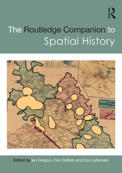
The Routledge Companion to Spatial History explores the full range of ways in which GIS can be used to study the past, considering key questions such as what types of new knowledge can be developed solely as a consequence of using GIS and how effective GIS can be for different types of research.
The Routledge Companion to Spatial History explores the full range of ways in which GIS can be used to study the past, considering key questions such as what types of new knowledge can be developed solely as a consequence of using GIS and how effective GIS can be for different types of research.
This volume offers comprehensive and up-to-date information on research in many different disciplines which give an overall insight into the environmental history of Africa.
This volume offers comprehensive and up-to-date information on research in many different disciplines which give an overall insight into the environmental history of Africa.
In recent decades, natural hazards have increasingly threatened lives, livelihoods, and economies, with annual losses totalling billions of dollars globally.
GlobalSoilMap: Digital Soil Mapping from Country to Globe contains contributions that were presented at the 2nd GlobalSoilMap conference, held 4-6 July 2017 in Moscow, Russian Federation.
GlobalSoilMap: Digital Soil Mapping from Country to Globe contains contributions that were presented at the 2nd GlobalSoilMap conference, held 4-6 July 2017 in Moscow, Russian Federation.
Ideal for both undergraduate and graduate students in the fields of geography, forestry, ecology, geographic information science, remote sensing, and photogrammetric engineering, LiDAR Remote Sensing and Applications expertly joins LiDAR principles, data processing basics, applications, and hands-on practices in one comprehensive source.
Ideal for both undergraduate and graduate students in the fields of geography, forestry, ecology, geographic information science, remote sensing, and photogrammetric engineering, LiDAR Remote Sensing and Applications expertly joins LiDAR principles, data processing basics, applications, and hands-on practices in one comprehensive source.
Desertification and land degradation are complex phenomena, and we need to understand their causes, consequences, and means to mitigate and combat their impact.
Desertification and land degradation are complex phenomena, and we need to understand their causes, consequences, and means to mitigate and combat their impact.
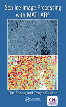
Sea Ice Image Processing with MATLAB addresses the topic of image processing for the extraction of key sea ice characteristics from digital photography, which is of great relevance for Artic remote sensing and marine operations.
Sea Ice Image Processing with MATLAB addresses the topic of image processing for the extraction of key sea ice characteristics from digital photography, which is of great relevance for Artic remote sensing and marine operations.