Now in its second edition, Geographic Information Systems (GIS) for Disaster Management has been completely updated to take account of new developments in the field.
Now in its second edition, Geographic Information Systems (GIS) for Disaster Management has been completely updated to take account of new developments in the field.
Radar scattering and imaging of rough surfaces is an active interdisciplinary area of research with many practical applications in fields such as mineral and resource exploration, ocean and physical oceanography, military and national defense, planetary exploration, city planning and land use, environmental science, and many more.
Radar scattering and imaging of rough surfaces is an active interdisciplinary area of research with many practical applications in fields such as mineral and resource exploration, ocean and physical oceanography, military and national defense, planetary exploration, city planning and land use, environmental science, and many more.
Big Data, Code and the Discrete City explores how digital technologies are gradually changing the way in which the public space is designed by architects, managed by policymakers and experienced by individuals.
Big Data, Code and the Discrete City explores how digital technologies are gradually changing the way in which the public space is designed by architects, managed by policymakers and experienced by individuals.
An original and wide-ranging study of the mappings used to impose meaning on the world, Mapping Reality argues that maps create rather than merely represent the ground on which they rest.
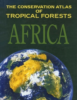
Recognizing that sound information is vital to the progress of conservation, IUCN have gathered together a visual portfolio of maps of rain forests in Africa.
Medical geography is a fascinating area of rapidly evolving study that aims to analyse and improve worldwide health issues based on the geographical factors which have an impact on them.
Medical geography is a fascinating area of rapidly evolving study that aims to analyse and improve worldwide health issues based on the geographical factors which have an impact on them.
A concise text presenting the fundamental concepts in Geographical Information Systems (GIS), emphasising an understanding of techniques in management, analysis and graphic display of spatial information.
A concise text presenting the fundamental concepts in Geographical Information Systems (GIS), emphasising an understanding of techniques in management, analysis and graphic display of spatial information.
Broadband is one of the most transformative technologies of the 21st century, yet our understanding of its regional impacts remains somewhat rudimentary.
Broadband is one of the most transformative technologies of the 21st century, yet our understanding of its regional impacts remains somewhat rudimentary.
Islands and their environs - aerial, terrestrial, aquatic - may be understood as intensifiers, their particular and distinctive geographies enabling concentrated study of many kinds of challenges and opportunities.
Real Estate and GIS focuses on the application of geographic information systems (GIS) and mapping technologies in the expanding property and real estate discipline.
Real Estate and GIS focuses on the application of geographic information systems (GIS) and mapping technologies in the expanding property and real estate discipline.
Like the first edition, the central question this book addresses is how virtual reality can be used in the design, production and management of the built environment.
Like the first edition, the central question this book addresses is how virtual reality can be used in the design, production and management of the built environment.
The Urban Data Management Society has organised international symposia at various locations throughout Europe since 1971, and UDMS 2013 marks its second visit to London.
With GIS technology increasingly available to a wider audience on devices from apps on smartphones to satnavs in cars, many people routinely use spatial data in a way which used to be the preserve of GIS specialists.
With GIS technology increasingly available to a wider audience on devices from apps on smartphones to satnavs in cars, many people routinely use spatial data in a way which used to be the preserve of GIS specialists.
Four unique pan-European CORINE Land Cover datasets-CLC1990, CLC2000, CLC2006, and CLC2012- and three datasets concerning changes between 1990 and 2012 have presented the first-ever opportunity to observe the European landscape by means of land cover and its change.
Driven by the societal needs and improvement in sensor technology and image processing techniques, remote sensing has become an essential geospatial tool for understanding the Earth and managing Human-Earth interactions.
Understand the current concept of wetland and methods for identifying, describing, classifying, and delineating wetlands in the United States with Wetland Indicators - capturing the current state of science's role in wetland recognition and mapping.
This book presents the fundamentals of polarimetric radar remote sensing through understanding wave scattering and propagation in geophysical media filled with hydrometers and other objects.
Based on the experiences of the Department of Information Engineering of the University of Pisa and the Radar and Surveillance System (RaSS) national laboratory of the National Interuniversity Consortium of Telecommunication (CNIT), Radar Imaging for Maritime Observation presents the most recent results in radar imaging for maritime observation.
Integrating Scale in Remote Sensing and GIS serves as the most comprehensive documentation of the scientific and methodological advances that have taken place in integrating scale and remote sensing data.
Environmental remote sensing plays a critical role in observing key hydrological components such as precipitation, soil moisture, evapotranspiration and total water storage on a global scale.