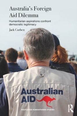
The Australian aid program faces a fundamental dilemma: how, in the absence of deep popular support, should it generate the political legitimacy required to safeguard its budget and administering institution?
The Australian aid program faces a fundamental dilemma: how, in the absence of deep popular support, should it generate the political legitimacy required to safeguard its budget and administering institution?
Extreme weather events, such as droughts, strong winds and storms, flash floods and extreme heat and cold, are among the most destructive yet fascinating aspects of climate variability.
Extreme weather events, such as droughts, strong winds and storms, flash floods and extreme heat and cold, are among the most destructive yet fascinating aspects of climate variability.
Climate change and urbanization are two of the greatest challenges facing humanity in the 21st century, and their effects are converging in dangerous ways.
Climate change and urbanization are two of the greatest challenges facing humanity in the 21st century, and their effects are converging in dangerous ways.
Since the first edition of The Human Side of Disaster was published in 2009, new catastrophes have plagued the globe, including earthquakes in Haiti and New Zealand, tornadoes in Alabama and Missouri, floods in numerous locations, Hurricane Sandy, and the infamous BP oil spill.
Since the first edition of The Human Side of Disaster was published in 2009, new catastrophes have plagued the globe, including earthquakes in Haiti and New Zealand, tornadoes in Alabama and Missouri, floods in numerous locations, Hurricane Sandy, and the infamous BP oil spill.
Natural disasters have long been seen as naturally generated events, but as scientific, technological, and social knowledge of disasters has become more sophisticated, the part that people and systems play in disaster events has become more apparent.
Natural disasters have long been seen as naturally generated events, but as scientific, technological, and social knowledge of disasters has become more sophisticated, the part that people and systems play in disaster events has become more apparent.
The apocalyptic visions of climate change that are projected in the media often involve extreme weather events, disasters and mass migration of poor people.
The apocalyptic visions of climate change that are projected in the media often involve extreme weather events, disasters and mass migration of poor people.
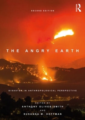
The Angry Earth explores how various cultures in different historical moments have responded to calamity, offering insight into the complex relationship between societies and their environments.
The Angry Earth explores how various cultures in different historical moments have responded to calamity, offering insight into the complex relationship between societies and their environments.
The second volume of this comprehensive global perspective on Integrated Drought Management is focused on drought modeling, meteorological prediction, and the use of remote sensing in assessing, analyzing, and monitoring drought.
This book examines the causes, consequences and policy implications of flooding in the US, covering hazard mitigation, hydrology, geography and environmental planning.
This book examines the causes, consequences and policy implications of flooding in the US, covering hazard mitigation, hydrology, geography and environmental planning.
Disaster policies present a new challenge to the practitioners and students of global politics; this book explains how political science enriches the contribution of the social sciences to the study of disaster relief, aid and reconstruction following the major disaster events, both natural and man-made, of recent times.
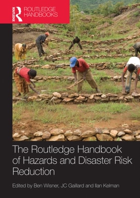
The Handbook provides a comprehensive statement and reference point for hazard and disaster research, policy making, and practice in an international and multi-disciplinary context.
The Handbook provides a comprehensive statement and reference point for hazard and disaster research, policy making, and practice in an international and multi-disciplinary context.
Europe has a long history of managing coastal erosion through a variety of protection strategies, from the defences of the Venice lagoons to coastal land reclamation in the Netherlands.
Europe has a long history of managing coastal erosion through a variety of protection strategies, from the defences of the Venice lagoons to coastal land reclamation in the Netherlands.
Recent catastrophic events, such as the I-35W bridge collapse, New Orleans flooding, the BP oil spill, Port au Prince's destruction by earthquake, Fukushima nuclear plant's devastation by tsunami, the Wall Street investment bank failures, and the housing foreclosure epidemic and the collapse of housing prices, all stem from what author Thomas Fisher calls fracture-critical design.
Recent catastrophic events, such as the I-35W bridge collapse, New Orleans flooding, the BP oil spill, Port au Prince's destruction by earthquake, Fukushima nuclear plant's devastation by tsunami, the Wall Street investment bank failures, and the housing foreclosure epidemic and the collapse of housing prices, all stem from what author Thomas Fisher calls fracture-critical design.
The blowout of the Deepwater Horizon and subsequent underground oil spill in the Gulf of Mexico in 2010 is considered by many to be the worst environmental disaster in U.
The blowout of the Deepwater Horizon and subsequent underground oil spill in the Gulf of Mexico in 2010 is considered by many to be the worst environmental disaster in U.