The Almer a Province of SE Spain, a semi-arid, tectonically active region, is the focus of a wide range of scientific teaching and research in the earth sciences by universities and associated bodies from around the world.
The study of palaeoweathering provides vital clues about past continental environments, the correlation of sedimentary deposits and processes such as the rate and timing of uplift and erosion.
Understanding of rivers and their sediments, both as modern systems and as ancient counterparts in the geological record, has progressed steadily but markedly over the past several decades, with contributions by practitioners in diverse fields of geosciences and engineering.
IAS Special Publication 35, Fluvial Sedimentology VII, comprises of a series of peer-reviewed papers that were initially presented at the 7th International Conference on Fluvial Sedimentology, held in Lincoln, Nebraska on August 6-10, 2001.
The motivation for this volume came from the idea that the Precambrian is the key, both to the present, and to the understanding of the Earth as a whole.
Calcretes are an important component of many ancient fluvial, lacustrine and shallow-marine carbonate sequences, and they are widely developed in many parts of the world at the present time.
Sedimentology Review is a new series of books edited by the Postgraduate Research Institute of Sedimentology (PRIS) and published by Blackwell Scientific Publications.
This IAS Special Publication #27 contains 17 of the papers presented at the IAS International Workshop on Reefs and Carbonate platforms in the Pacific and Indian oceans held in Sydney (July 1995).
Given current environmental concerns, it is not surprising to find literary critics and theorists surveying the Romantic poets with ecological hindsight.
Mountain ranges are the most conspicuous elements of the earth's architecture, and the manner in which the architectural units are arranged or disarranged has become the study of a subdivision of geology known as Tectonics.
A symposium of the Royal Society of Canada was held in June 1962 to outline what is being done in Canadian oceanography to map salinity, temperature, and plankton in the waters around Canada and in the North Atlantic across to Europe.
The Chinese Oil Industry: History and Future presents a wealth of tables and figures with new data on Chinese fossil fuel production and consumption, together with a peak oil model to forecast future trends in energy supply and demand.
More than seventeen years have passed now since Glauco Gottardi and Ermano Galli 1 have published their remarkable book on NATURAL ZEOLITES where properties and features of naturally occuring phases then available have been compiled.
The management and disposal of radioactive wastes are key international issues requiring a sound, fundamental scientific basis to insure public and environmental protection.
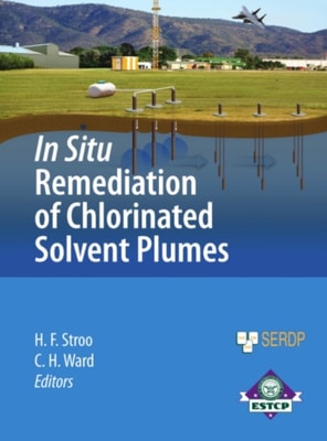
This volume provides comprehensive up-to-date descriptions of the principles and practices of in situ chemical oxidation (ISCO) for groundwater remediation based on a decade of intensive research, development, and demonstrations, and lessons learned from commercial field applications.
Newfoundland lies at the intersection of arctic and more temperate regions and, commensurate with this geography, populations of two Amerindian and two Paleoeskimo cultural traditions occupied Port au Choix, in northern Newfoundland, Canada, for centuries and millennia.
Since the 1960s, x-ray fluorescence spectrometry (XRF), both wavelength and energy-dispersive have served as the workhorse for non-destructive and destructive analyses of archaeological materials.
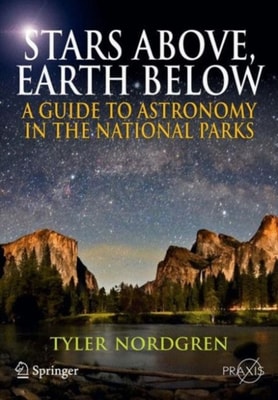
Stars Above, Earth Below uses photographs and sky charts to form a connection between what is seen on the ground and in the sky, and looks at the deeper scientific meaning behind these sights.
The Indian National Science Academy was established in January 1935 with the objective of promoting science in India and harnessing scientific knowledge for the cause of humanity and national welfare.
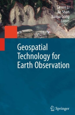
Earth Observation interacts with space, remote sensing, communication, and information technologies, and plays an increasingly significant role in Earth related scientific studies, resource management, homeland security, topographic mapping, and development of a healthy, sustainable environment and community.
Engineers are expected to design structures and machines that can operate in challenging and volatile environments, while allowing for variation in materials and noise in measurements and signals.
Completely revised and updated, incorporating almost a decade's worth of developments in this field, Environmental Soil Science, Third Edition, explores the entire reach of the subject, beginning with soil properties and reactions and moving on to their relationship to environmental properties and reactions.
Boundaries of a wetland must be identified and located in the field by examining three parameters: wetland plants, wetland hydrology, and hydric soils.
Geospatial information modeling and mapping has become an important tool for the investigation and management of natural resources at the landscape scale.
A thorough knowledge of geology is essential in the design and construction of infrastructures for transport, buildings and mining operations; while an understanding of geology is also crucial for those working in urban, territorial and environmental planning and in the prevention and mitigation of geohazards.
Introduction to Process Geomorphology provides an integrative approach to the process dynamics and the origin of landforms by the contemporary processes involved in their evolution.
Presenting a nonmathematical approach to this topic, Statistics for Environmental Science and Management introduces frequently used statistical methods and practical applications for the environmental field.
In 2007, the first edition of Handbook of Plant Nutrition presented a compendium of information on the mineral nutrition of plants available at that time-and became a bestseller and trusted resource.
A thorough knowledge of geology is essential in the design and construction of infrastructures for transport, buildings and mining operations; while an understanding of geology is also crucial for those working in urban, territorial and environmental planning and in the prevention and mitigation of geohazards.