This book reviews and summarizes the development and achievement in cartography and geographic information engineering in China over the past 60 years after the founding of the People's Republic of China.
In this beautifully conceived book, Ayesha Ramachandran reconstructs the imaginative struggles of early modern artists, philosophers, and writers to make sense of something that we take for granted: the world, imagined as a whole.
Though the practical value of maps during the sixteenth century is well documented, their personal and cultural importance has been relatively underexamined.
Almost universally, newly independent states seek to affirm their independence and identity by making the production of new maps and atlases a top priority.
The book is presented as an Atlas where the map plays a fundamental role in the study of quality of life, as it shows its progression in Argentina from the 19th to the 21st Century.
This book analyzes the drawing data and methods of the Chinese ancient maps that are neglected by the previous researches, and reevaluates the drawing theories and methods, the influences, and accuracy of the maps that represents the scientificity of Chinese ancient cartographic drawings.
Dieses Lehr- und Übungsbuch richtet sich an Sie als Studierende und praktisch tätige Fachleute der Geodäsie, der Geomatik, der Vermessung, der Ingenieurmathematik und verwandter Fachrichtungen.
Publisher's Note: Products purchased from Third Party sellers are not guaranteed by the publisher for quality, authenticity, or access to any online entitlements included with the product.
The definitive guide to photogrammetry--fully updatedThoroughly revised to cover the latest technological advances in the field, Elements of Photogrammetry with Applications in GIS, Fourth Edition, provides complete details on the foundational principles of photogrammetry as well as important advanced concepts.
Reflexive Cartography addresses the adaptation of cartography, including its digital forms (GIS, WebGIS, PPGIS), to the changing needs of society, and outlines the experimental context aimed at mapping a topological space.
Adjustment Models in 3D Geomatics and Computational Geophysics: With MATLAB Examples, Volume Four introduces a complete package of theoretical and practical subjects in adjustment computations relating to Geomatics and geophysical applications, particularly photogrammetry, surveying, remote sensing, GIS, cartography, and geodesy.
At the turn of the fifteenth century, Rome was in the midst of a dramatic transformation from what the fourteenth-century poet Petrarch had termed a "e;crumbling city"e; populated by "e;broken ruins"e; into a prosperous Christian capital.
More than just colorful clickbait or pragmatic city grids, maps are often deeply emotional tales: of political projects gone wrong, budding relationships that failed, and countries that vanished.
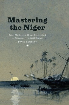
In Mastering the Niger, David Lambert recalls Scotsman James MacQueen (1778-1870) and his publication of A New Map of Africa in 1841 to show that Atlantic slavery-as a practice of subjugation, a source of wealth, and a focus of political struggle-was entangled with the production, circulation, and reception of geographical knowledge.
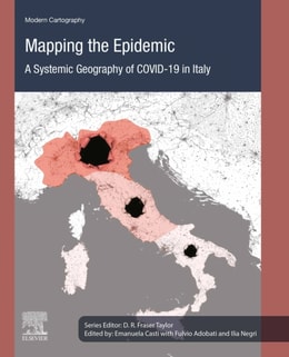
Mapping the Epidemic: A Systemic Geography of COVID-19 in Italy provides a theoretical-methodological framework based on space-time analysis to map and interpret the set of factors that could have contributed to the spread of COVID-19, as well as a reflexive cartographic mapping visualizing the virus's dynamics.
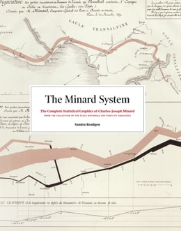
If you have any interest in information graphics, maps, or history, you know of the seminal flow map of Napoleon's 1812 march into Russia by Charles-Joseph Minard, made famous by Edward Tufte, and considered to be one of the most magnificent data graphics ever produced.
This book delivers stimulating input for a broad range of researchers, from geographers and ecologists to psychologists interested in spatial perception and physicists researching in complex systems.
This book brings together ten empirically rich and theoretically informed contributions that aim to clarify both geo-historical specificities and common transnational and global features of the cultures and practices of boundary making that shaped modern statehood.
This book presents a selection of manuscripts submitted to the 2nd International Conference on Geospatial Information Sciences 2021, a virtual conference held on November 3-5, 2021.
This book broadens the reader's knowledge base on lithofacies distribution, facies succession and association, and interpretation of paleo-depositional environments using outcrop-based and measured se dimentologic section data integrated with facies and petrographic analyses.
Diario de la navegación que va a hacer don Basilio Villarino, segundo piloto de la Real Armada, con las dos embarcaciones de su mando, el bergantín Nuestra Señora de Carmen y Ánimas, y la chalupa San Francisco de Asís, desde el Río Negro, a reconocer la costa, la Bahía de Todos los Santos, Islas del Buen Suceso y demás adyacentes, buscar el desagüe del río Colorado, y penetrar su entrada, de orden del Comisario Superintendente de estos establecimientos, el señor don Francisco de Viedma.
Since the last decades of the twentieth century, the circumstances surrounding map use and map making have drastically changed owing to advances in information and communication technologies (ICTs).
Representation of geographical data using graphs, diagrams and mapping techniques is a key for geographers and for researchers in other disciplines to explore the nature of data, the pattern of spatial and temporal variations and their relationships, and formulation of principles to accurately understand and analyze features on or near the earth's surface.
The Routledge Handbook of Geospatial Technologies and Society provides a relevant and comprehensive reference point for research and practice in this dynamic field.
The Routledge Handbook of Geospatial Technologies and Society provides a relevant and comprehensive reference point for research and practice in this dynamic field.
A contemporary follow-up to the groundbreaking Power of Maps, this book takes a fresh look at what maps do, whose interests they serve, and how they can be used in surprising, creative, and radical ways.
This book introduces the use of various remote sensing data such as microwave, hyperspectral and very high-resolution (VHR) satellite imagery; mapping techniques including pixel and object-based machine learning; and geostatistical modelling techniques including cellular automation, entropy and land fragmentation.
This book introduces the use of various remote sensing data such as microwave, hyperspectral and very high-resolution (VHR) satellite imagery; mapping techniques including pixel and object-based machine learning; and geostatistical modelling techniques including cellular automation, entropy and land fragmentation.
While the twentieth century's conflicting visions and exploitation of the Middle East are well documented, the origins of the concept of the Middle East itself have been largely ignored.
Developments in the Theory and Practice of Cybercartography-awarded an Honorable Mention in Earth Science at the Association of American Publishers' 2015 PROSE Awards-examines some of the recent developments in the theory and practice of cybercartography and the substantial changes which have taken place since the first edition published in 2005.
Understanding Geology through Maps guides young professional geologists and students alike in understanding and interpreting the world's dynamic and varying geological landscapes through the liberal use of visual aids including figures, maps, and diagrams.