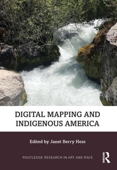
Employing anthropology, field research, and humanities methodologies as well as digital cartography, and foregrounding the voices of Indigenous scholars, this text examines digital projects currently underway, and includes alternative modes of "e;mapping"e; Native American, Alaskan Native, Indigenous Hawaiian and First Nations land.
Employing anthropology, field research, and humanities methodologies as well as digital cartography, and foregrounding the voices of Indigenous scholars, this text examines digital projects currently underway, and includes alternative modes of "e;mapping"e; Native American, Alaskan Native, Indigenous Hawaiian and First Nations land.
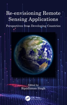
Re-envisioning Remote Sensing Applications: Perspectives from Developing Countries aims at discussing varied applications of remote sensing, with respect to upcoming technologies with diverse themes.
Re-envisioning Remote Sensing Applications: Perspectives from Developing Countries aims at discussing varied applications of remote sensing, with respect to upcoming technologies with diverse themes.
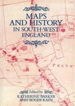
This volume of essays considers the practical and political purposes for which maps were used, the symbolic and ideological roles of maps in the history of South-Western England and the ways in which map evidence can be used to recover facts about the past for use in the writing of history.
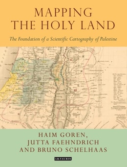
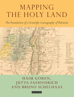
Through a detailed study of the work of three of the leading figures of the era - Augustus Petermann, Physical Geographer Royal to Queen Victoria; cartographer Charles Meredith van de Velde, who produced the finest map of the region at the time; and Edward Robinson, founder of modern Palestinology - the authors explore the complex cultural, cartographic and technical processes that shaped and determined the resulting maps of the region.
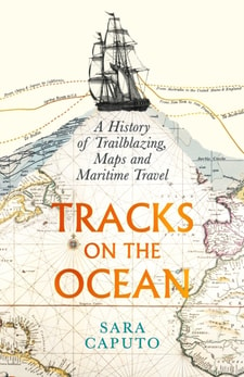
Longlisted for the 2025 BSHS Hughes Prize 'Enthralling' Philip Ball'Ingenious' Sujit SivasundaramIn Tracks on the Ocean, Sara Caputo tells how our journeys around the globe became fixed lines on maps - and how journey lines themselves reshaped maps and the way that we view the world.
Bernardo de Miera y Pacheco (1713-1785) is remembered today not only as colonial New Mexico's preeminent religious artist, but also as the cartographer who drew some of the most important early maps of the American West.
Antonio Garcia Cubas's Carta general of 1857, the first published map of the independent Mexican nation-state, represented the country's geographic coordinates in precise detail.
From the first vistas provided by flight in balloons in the eighteenth century to the most recent sensing operations performed by military drones, the history of aerial imagery has marked the transformation of how people perceived their world, better understood their past, and imagined their future.
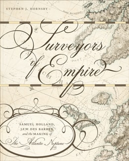
Using research from both sides of the Atlantic, Stephen Hornsby examines the development of British military cartography in North America during and after the Seven Years War, as well as advancements in military and scientific equipment used in surveying.
Charting Northern Waters also offers a detailed review of Russian hydrography on their northern coast from 1900 to 1940 and an in-depth discussion of American oceanographic work in the north in 1951.
This book focuses on the work of the great sixteenth-century traveller and map-maker Andre Thevat and explores the interrelations between representation and power in the age of discovery.
In addition to being a fundamental concept for planning the water infrastructure which supports extensive agricultural economies across Southeast Asia, knowledge of the Mekong River's hydrological catchments has calibrated the control of land, resources and people.
Further Developments in the Theory and Practice of Cybercartography, Third Edition, Volume Nine, presents a substantively updated edition of a classic text on cybercartography, presenting new and returning readers alike with the latest advances in the field.
WINNER OF THE CANTEMIR PRIZE 2012 awarded by the Berendel Foundation The Map Reader brings together, for the first time, classic and hard-to-find articles on mapping.
WINNER OF THE CANTEMIR PRIZE 2012 awarded by the Berendel Foundation The Map Reader brings together, for the first time, classic and hard-to-find articles on mapping.
Classics in Cartography provides an intellectually-driven reinterpretation of a selection of ten touchstone articles in the development of mapping scholarship over the last four decades.
Remotely-sensed images of the Earth's surface provide a valuable source of information about the geographical distribution and properties of natural and cultural features.
Further Developments in the Theory and Practice of Cybercartography, Third Edition, Volume Nine, presents a substantively updated edition of a classic text on cybercartography, presenting new and returning readers alike with the latest advances in the field.
Developments in the Theory and Practice of Cybercartography-awarded an Honorable Mention in Earth Science at the Association of American Publishers' 2015 PROSE Awards-examines some of the recent developments in the theory and practice of cybercartography and the substantial changes which have taken place since the first edition published in 2005.
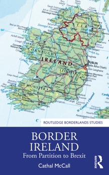
When the 1998 Good Friday Agreement brought an end to decades of conflict, which was mainly focused on the existence of the Irish border, most breathed a sigh of relief.
When the 1998 Good Friday Agreement brought an end to decades of conflict, which was mainly focused on the existence of the Irish border, most breathed a sigh of relief.
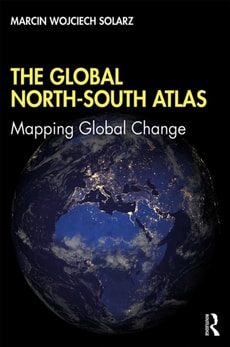
This innovative atlas deconstructs the contemporary image of the North-South divide between developed and underdeveloped countries which was established by the 1980 Brandt Line, and advocates the need for the international community to redraw the global map to be fit for the 21st century.
This innovative atlas deconstructs the contemporary image of the North-South divide between developed and underdeveloped countries which was established by the 1980 Brandt Line, and advocates the need for the international community to redraw the global map to be fit for the 21st century.
Mapping Paradigms in Modern and Contemporary Art defines a new cartographic aesthetic, or what Simonetta Moro calls carto-aesthetics, as a key to interpreting specific phenomena in modern and contemporary art, through the concept of poetic cartography.
Mapping Paradigms in Modern and Contemporary Art defines a new cartographic aesthetic, or what Simonetta Moro calls carto-aesthetics, as a key to interpreting specific phenomena in modern and contemporary art, through the concept of poetic cartography.
Mapping the Epidemic: A Systemic Geography of COVID-19 in Italy provides a theoretical-methodological framework based on space-time analysis to map and interpret the set of factors that could have contributed to the spread of COVID-19, as well as a reflexive cartographic mapping visualizing the virus's dynamics.
Mapping and Forecasting Land Use: The Present and Future of Planning is a comprehensive reference on the use of technologies to map land use, focusing on GIS and remote sensing applications and methodologies for land use monitoring.
Mapping and Forecasting Land Use: The Present and Future of Planning is a comprehensive reference on the use of technologies to map land use, focusing on GIS and remote sensing applications and methodologies for land use monitoring.
The definitive guide to photogrammetry--fully updatedThoroughly revised to cover the latest technological advances in the field, Elements of Photogrammetry with Applications in GIS, Fourth Edition, provides complete details on the foundational principles of photogrammetry as well as important advanced concepts.
Publisher's Note: Products purchased from Third Party sellers are not guaranteed by the publisher for quality, authenticity, or access to any online entitlements included with the product.