A collection of photographs of Lowestoft and Southwold and the villages in between, dating from the late 19th and early 20th centuries, with separate sections on Fishing, Lifeboats, the Seaside and People.
Anyone reading this book who is old enough to remember some of the old scenes and buildings of the area may find that they are surprised at how much Havering has changed in the not too distant past.
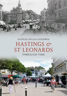
'Hastings and St Leonards, the charming marine resort of fashionable English society, possess attractions and recommendations that render the borough unique and unrivalled among English watering places.
Evesham to Bredon in Old Photographs offers a captivating glimpse into the history of this area, providing the reader with a visual representation of Evesham and Bredon's intriguing and chequered history.
In the 1850s the area consisted of three villages - Turnham Green along the main road to the west and the riverside hamlets of Chiswick and Strand on the Green, separated by fields, market gardens and the grounds of several large mansions.
Now that the railway has gone and most visitors disembark from the car and coach bays above the world-famous caves, this book explores Cheddar past and present from the top of its dramatic gorge to the substantial reservoir beyond the bustling village below.
Brighouse Through Time provides a unique opportunity to look, not only at the present day town centre that many readers will be familiar with, but also how many parts appeared particularly during the nineteenth and twentieth centuries.
The railway network within Birmingham has long been important for the movement of passengers and freight to serve the centre and its suburbs, and as the road network around Birmingham has become more congested, the railways in the city have, once more, taken on an important role.
The photographs in this fascinating selection document the changes which overtook the county town of Staffordshire in the century following the discovery of photography.
The town, historically known as 'Rudgeley', is listed in the Domesday Book and it is thought that the name derives from 'Ridge lee', or 'the hill over the field'.
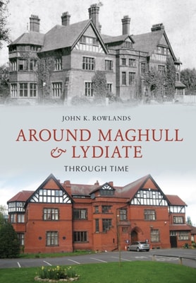
This book, a collection of photographs of rural dwellings that have long since vanished, and those that still stand but have changed beyond all recognition, records the changes inflicted upon the Lancashire townships of Maghull and Lydiate by the turnpike, the canal, the railways and the more modern demands of nearby Liverpool.
Commencing at the Nore, Thames-side Kent follows the course of a ship inward bound, presenting a nostalgic study of the southern bank of the River Thames as far as the county of Kent extends, the mouth of the River Darenth, also known as Dartford Creek.
Reading some of the descriptions of the Black Country in the nineteenth century, one could be forgiven for believing the area stood at the gates of Hell.
From Whitstable, with its oyster beds and fishing fleet, to Chatham and Rochester, the Medway and Swale areas have seen a diverse variety of shipping over the years, from the fishing smacks to men of war, Thames barges, sailing vessels, submarines, pleasure steamers, ferries and cargo ships.